Some time ago, the 'big brother' google started the maps service, offering satellite imagery easy to access by everyone. One of the key features in this service, opens access to use their maps thru a well documented API, so you can integrate these maps in your own page, place points of interest or even draw overlaying paths.
Using this API, a PDA and a GPS bluetooth, we'll make a simple approach to automatically draw a route map of our biking excursions.
First of all you need to do (for example) a biking day to record all the route you do. In my case, I used a bluetooth GPS to send position information to a (well protected inside my bag) bluetooth PDA. The pocket PC was running VisualGPSce which allows us to show information received by the bluetooth GPS or record the information directly in a file.
This utility stores information directly received from the GPS in NMEA format, so once we get back to our home we'll have to convert this information into a 'more usable' format.
The fastest way I found to convert this kind of files is by using GPSbabel, a easy tool which will save our NMEA data file in GPX coordinate format. The GPX format is an open subset of XML specially designed to transfer GPS information. We're using this format because of the wide quantity of tools available to process this kind of files, there are even PHP libraries which we could use in our webpage.
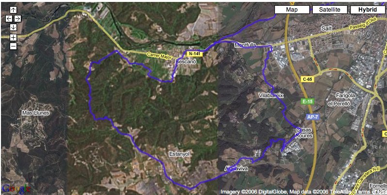
Now that we have converted to the GPX format, we put the file on our web server, next to the necessary code to make google maps generate the required map, and draw our route over it.
To do this we will require a google maps API key, which can be obtained freely here.
To be continued...